Radar Vegetation Index (RVI) and RVI for Sentinel-1 SAR data (RVI4S1)
What is Radar Vegetation Index (RVI) and what is Radar Vegetation Index for Sentinel-1 SAR data (RVI4S1)?
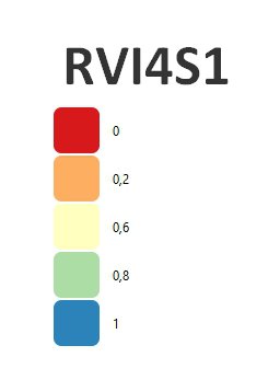
The RVI index is used to monitor crop growth. The theoretical value of this index varies from 0 to 1. A very low RVI index, which tends towards zero, corresponds to bare soil or pure elementary targets. Conversely, the RVI increases as crop grows (up to different points in the growth cycle), a high value tending towards 1 corresponds to a fully developed plant cover. The RVI4S1 index is a RVI index created from radar images of the Sentinel-1 satellite.
How do you calculate RVI and RVI4S1?
It is calculated as:
RVI = 8σHV/(σHH+σVV+2σHV)
Where σ HH and σ VV are like polarized backscattering coefficients and σ HV is cross polarization coefficients in power units. The RVI4S1 calculation requires a custom script (please check the references).
References:
https://custom-scripts.sentinel-hub.com/custom-scripts/sentinel-1/radar_vegetation_index/
Sahadevan, D. K., Sitiraju, S., & Sharma, J. (2013). Radar Vegetation Index as an Alternative to NDVI for Monitoring of Soyabean and Cotton.
Example of RVI4S1, Rostenice farm